
Forestry drone surveys
Compartment planning, extraction routes, restocking and windblow assessment, measured across the whole wood.
A drone scan covers the whole wood at around three centimetres per pixel. It produces an orthomosaic, a single measurable aerial photograph of the site, plus surface and terrain models from which canopy height is derived.
Managers, agents and contractors work from the same survey, and it holds as a baseline you can return to as new questions arise.
Managing habitat rather than timber? See Land & Conservation
Where a scan earns its place
A scan earns its place where decisions carry long-term structural or financial consequence: restructuring, extraction routes, harvesting design, restocking, windblow assessment and grant applications.
Stand structure is read across the whole wood, compartment by compartment, and everyone reviews the same baseline before resources are committed. Where your existing records already hold what you need, we will maximise their value first: see mapping and cartography.
What actually changes
With a current scan on screen, discussions move faster. Compartments are reviewed in context, extraction routes assessed against the terrain model, and canopy height derived across the whole site.
Individual tree detection supports stocking density counts and height measurement by compartment.
- Woodland restructuring and compartment planning
- Access and extraction route planning
- Harvesting design and coupe layout
- Restocking assessment and monitoring
- Windblow and storm damage assessment
- Grant applications and scheme compliance
From imagery to a plan you can work from
The scan is the raw material. What a manager works from is drawn off it: compartments bounded and measured, species recorded, areas totalled to the hectare, and the whole sheet set on the British National Grid.
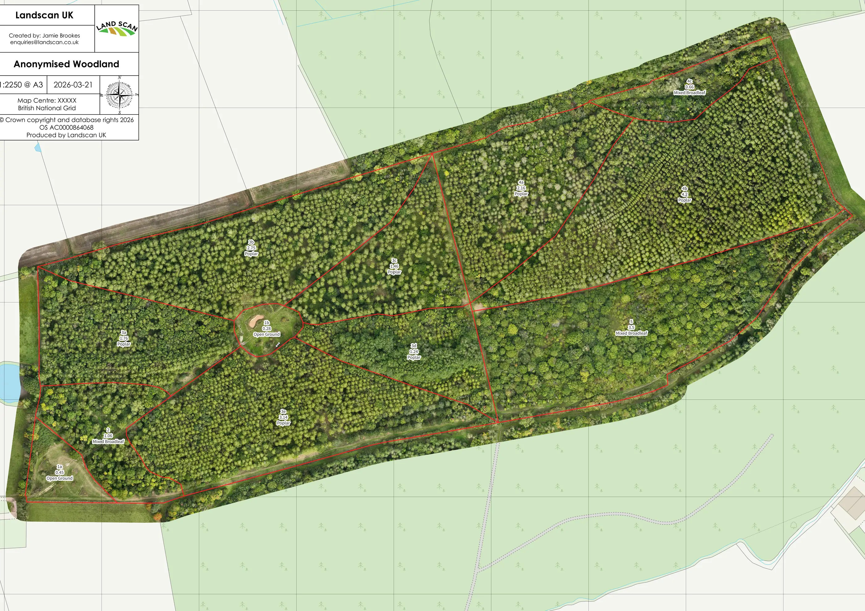
Feature extraction, area measurement and annotated mapping come off the same survey. Compartment maps and felling plans can also be drawn from records you already hold, with no new flight: see mapping and cartography.
Repeatable, reliable
Scans are georeferenced to the British National Grid and measurable throughout, at sub-metre positional accuracy. Three centimetres per pixel is the detail you can see in the image; positional accuracy is how closely that detail sits to its true place on the ground. That is the level woodland planning calls for.
Outputs integrate with existing GIS workflows, or come as high-resolution images anyone can open and share without GIS software.
We work alongside qualified inspectors and surveyors. A scan gives them the whole woodland to look at, so time on the ground goes where it is needed.
- Experience
- Surveying woodland since 2020Projects across the UK
- Scale
- 2,400 hectaresOur largest single orthomosaic
- Published
- Quarterly Journal of ForestryAnd Forestry & Timber News
- Teaching
- Royal Forestry SocietyDrone Surveys in Forestry course
Considering a baseline for your woodland?
If you are weighing this up for a wood you manage, or want a baseline survey of it, we are happy to advise before you decide.