
Land Management & Conservation
Measurable aerial baselines for restoration, habitat management and long-term monitoring.
A drone scan records the whole site in one pass, at around three centimetres per pixel. It produces a single measurable aerial photograph, plus surface and terrain models showing vegetation structure and ground form.
It creates a consistent visual baseline you can return to as restoration, habitat management or land use change progresses.
Managing woodland for timber? See Forestry
Planning before anyone walks the site
With a current scan, decisions can be planned in context and detailed survey work targeted to specific areas before anyone sets foot on site.
Habitat structure and site condition can be reviewed across the whole landscape in a single pass. The scan becomes a shared visual reference between land managers, ecologists, funders and trustees as projects develop.
A record you can return to
Conservation interventions are phased, and outcomes are assessed over years. A scan flown now is the reference every later phase is measured against.
Flown again on the same parameters, it shows what has changed and by how much.
From imagery to something you can act on
The scan is the raw material. What comes off it is measured and mapped: canopy picked out automatically, terrain contoured, and the features that matter for management marked where they sit.
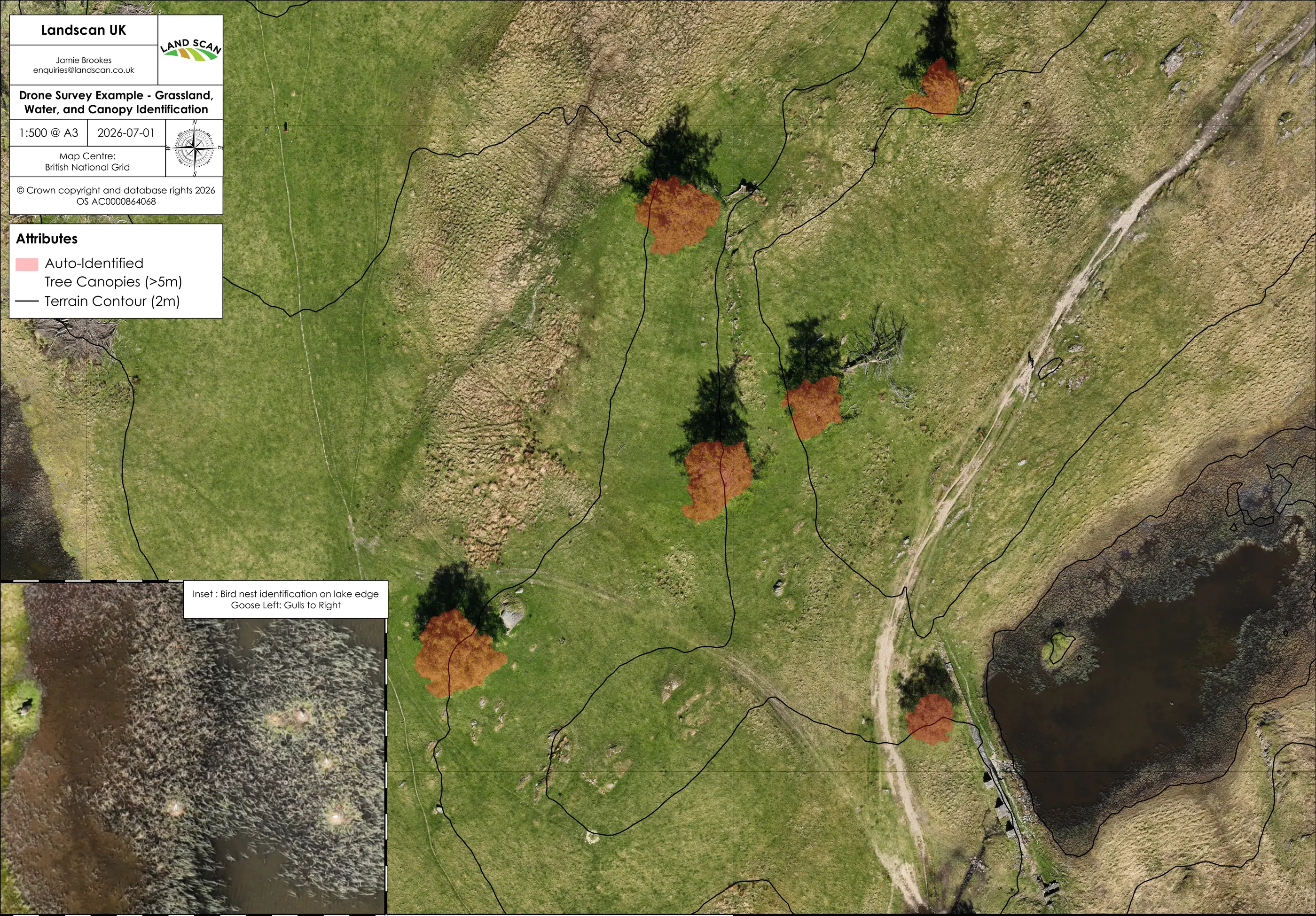
Habitat mapping, area measurement and annotated outputs for funders are all drawn from the one flight. Where you already hold the records, the mapping can be done without a new flight at all: see mapping and cartography.
Spending the budget in the right place
Conservation and land management decisions are shaped by funding constraints, phased restoration plans, and the need to demonstrate condition clearly. A scan gives whole-site visibility before intervention, so resources go to the areas of greatest need.
Change you can prove
Every scan is tied to the British National Grid, so one flown in five years lines up with this one and the two can be compared directly. Positional accuracy is sub-metre, which is what restoration planning and habitat management call for.
Outputs drop into whatever GIS you already use. They also come as high-resolution images that partners, funders and trustees can open on any machine, with nothing to install.
Ecologists and qualified surveyors work from the same scan, so the time they spend on the ground goes where it counts.
Establishing a baseline for your site?
Tell us about the site and what you need it to show, and we will advise before anything is committed.